
-
Upazila Related
About Upazila
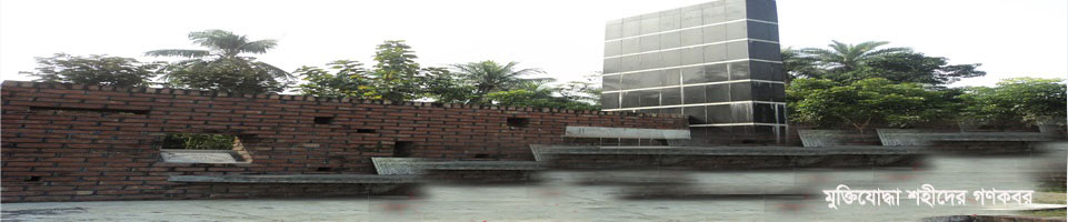
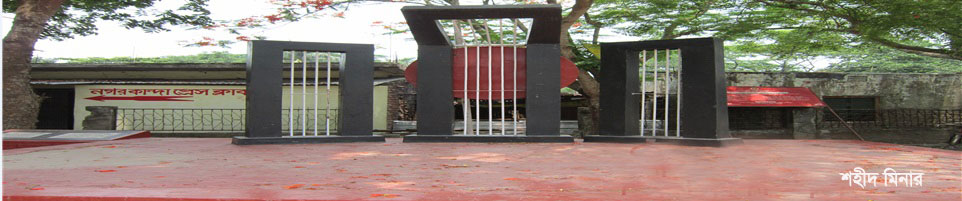
History-Tradition
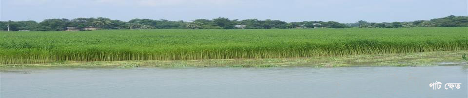
Geographical and Economic
ভাতাভোগীদের তথ্য
-
Upazila Parishad
Upazila Parishad Related
-
বার্ষিক উন্নয়ন পরিকল্পনা (২০২১-২২)
-
Citizen Charter
-
পঞ্চবার্ষিকী পরিকল্পনা
-
২০২১-২২ অর্থ বছরে ১৭টি উপজেলা কমিটির সংশ্লিষ্ট সভার সমূহের কার্যবিবরণী
-
এডিপি অগ্রগতি রিপোর্ট (২০২০-২১)
-
Focal Point
-
২০২০-২১ অর্থ বছরের আর্থিক প্রতিবেদন
-
২০২১-২২ অর্থ বছরের উপজেলা পরিষদের মাসিক সভার কার্যবিবরণী
-
এডিপি অগ্রগতি রিপোর্ট (২০২০-২১)
-
Employees
-
Laws and Regulations
প্রকল্পের তালিকা
-
২০২২-২০২৩ অর্থবছরে (১ম পর্যায়) গ্রামীণ অবকাঠামো সংস্কার (কাবিটা) উপজেলাওয়ারী উন্নয়ন প্রকল্পের তালিকা
-
২০২৩-২৪ অর্থ বছরের টি আর উন্নয়ন প্রকল্পের তালিকা
-
স্থাবর সম্পত্তি হস্তান্তর করের ১% হতে বাস্তবায়িত প্রকল্পের তালিকা
-
২০২২-২৩ অর্থ বছরের টি আর, কাবিখা, কাবিটা ও বিভিন্ন উন্নয়ন প্রকল্পের তালিকা
-
২০২২-২৩ অর্থ বছরে বার্ষিক উন্নয়ন কর্মসূচী (এ ডি পি) এর আওতায় প্রাপ্ত স্কীমের তালিকা
-
২০২২-২৩ অর্থ বছরে উপজেলা পরিষদ উন্নয়ন তহবিল এর আওতায় প্রাপ্ত স্কীমের তালিকা
ইজারাকৃত হাটবাজার এবং জলমহালের তালিকা
-
বার্ষিক উন্নয়ন পরিকল্পনা (২০২১-২২)
-
Upazila Administration
Chief Executive Officer
About Office
Important Information
-
The Municipality
Introduction to Municipality
Municipality Employee
Municipality Activities
-
Government office
Law and order
On health matters
On agriculture and food
Engineering and Communication
Land matters
Human resource development matters
Education Related
-
Other organizations
Educational Institutions
-
E-service
District e-service center
National e-service
Upazila ICT Center
Ministries
Visa checks and others
Collection of tickets online
- Gallery
- Online hearing
-
projects
Fiscal Year 2022-2023
-
Report on projects implemented with concessional funds and revenue funds in favor of local government institutions
- List of schemes implemented from 1% of Immovable Property Transfer Tax
-
List of TR, Kabikha, Kabita and various development projects for the financial year 2022-23
-
List of schemes received under the Annual Development Program (ADP) in the financial year 2022-23
-
List of schemes received under Upazila Parishad Development Fund in the financial year 2022-23
-
Report on projects implemented with concessional funds and revenue funds in favor of local government institutions
-
Upazila Related
About Upazila
History-Tradition
Geographical and Economic
ভাতাভোগীদের তথ্য
বীর মুক্তিযোদ্ধাদের সমন্বিত তালিকা
-
Upazila Parishad
Administrator
Upazila Parishad Related
- বার্ষিক উন্নয়ন পরিকল্পনা (২০২১-২২)
- Citizen Charter
- পঞ্চবার্ষিকী পরিকল্পনা
- ২০২১-২২ অর্থ বছরে ১৭টি উপজেলা কমিটির সংশ্লিষ্ট সভার সমূহের কার্যবিবরণী
- এডিপি অগ্রগতি রিপোর্ট (২০২০-২১)
- Focal Point
- ২০২০-২১ অর্থ বছরের আর্থিক প্রতিবেদন
- ২০২১-২২ অর্থ বছরের উপজেলা পরিষদের মাসিক সভার কার্যবিবরণী
- এডিপি অগ্রগতি রিপোর্ট (২০২০-২১)
- Employees
- Laws and Regulations
প্রকল্পের তালিকা
- ২০২২-২০২৩ অর্থবছরে (১ম পর্যায়) গ্রামীণ অবকাঠামো সংস্কার (কাবিটা) উপজেলাওয়ারী উন্নয়ন প্রকল্পের তালিকা
- ২০২৩-২৪ অর্থ বছরের টি আর উন্নয়ন প্রকল্পের তালিকা
- স্থাবর সম্পত্তি হস্তান্তর করের ১% হতে বাস্তবায়িত প্রকল্পের তালিকা
- ২০২২-২৩ অর্থ বছরের টি আর, কাবিখা, কাবিটা ও বিভিন্ন উন্নয়ন প্রকল্পের তালিকা
- ২০২২-২৩ অর্থ বছরে বার্ষিক উন্নয়ন কর্মসূচী (এ ডি পি) এর আওতায় প্রাপ্ত স্কীমের তালিকা
- ২০২২-২৩ অর্থ বছরে উপজেলা পরিষদ উন্নয়ন তহবিল এর আওতায় প্রাপ্ত স্কীমের তালিকা
ইজারাকৃত হাটবাজার এবং জলমহালের তালিকা
-
Upazila Administration
Chief Executive Officer
About Office
Important Information
-
The Municipality
Introduction to Municipality
Municipality Employee
Municipality Activities
-
Government office
Law and order
On health matters
On agriculture and food
Engineering and Communication
Land matters
Human resource development matters
Education Related
-
Other organizations
Educational Institutions
-
E-service
District e-service center
National e-service
Upazila ICT Center
Ministries
Visa checks and others
Collection of tickets online
-
Gallery
Vedio Gallery
Photo Gallery
-
Online hearing
মামলার তালিকা
এডমিন লগইন
-
projects
Fiscal Year 2022-2023
- Report on projects implemented with concessional funds and revenue funds in favor of local government institutions
- List of schemes implemented from 1% of Immovable Property Transfer Tax
- List of TR, Kabikha, Kabita and various development projects for the financial year 2022-23
- List of schemes received under the Annual Development Program (ADP) in the financial year 2022-23
- List of schemes received under Upazila Parishad Development Fund in the financial year 2022-23
Fiscal Year 2023-2024
Fiscal Year 2024-2025
The area of this upazila is 191.98 sq km. The river Kumar, which flows through chest in Nagarkanda with a population of about 200,000, is locally known as Shitalaksha. This upazila is located in the southern part of Faridpur district. Nagarkanda is bounded on the north by Faridpur Sadar and Charbhadrasan upazilas, on the east by Sadarpur and Bhanga upazilas, on the south by Muksudpur upazila of Gopalganj district and on the west by Saltha upazila. It is situated between 23:18 and 23:34 degrees north latitude and between 89:43 and 69:58 degrees east longitude. The distance from Faridpur district headquarters to Nagarkanda police station is about 25 km.


Planning and Implementation: Cabinet Division, A2I, BCC, DoICT and BASIS
Technical Assistance:
![]()
Developed By: